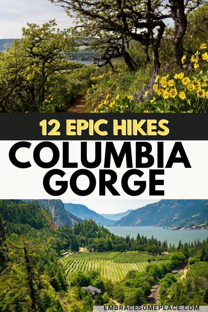
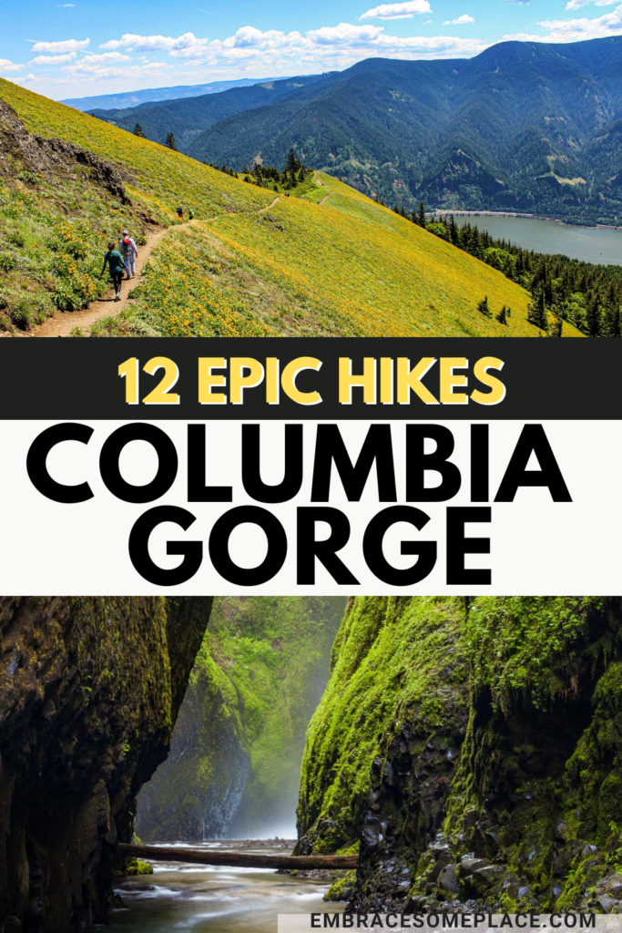
Looking for the best hikes in the Columbia Gorge? You’re in luck. I spent most of my high school and college years exploring the area on the weekends.
The Gorge has a very special place in my heart, which is why I spend most of my summer weekends there now. All this to say, I know the area like the back of my hand and can easily rattle off a list of the best Columbia Gorge hiking trails because I’ve hiked most of firsthand.
Without further ado, allow me to share my personal list of the best hikes in the Columbia Gorge for all skill levels.
You May Also Enjoy Reading: All 12 Gorge Breweries (Ranked) & 18 Relaxing Hood River Wineries Worth Enjoying

Best Hikes Columbia Gorge
Easy Hikes in the Columbia Gorge
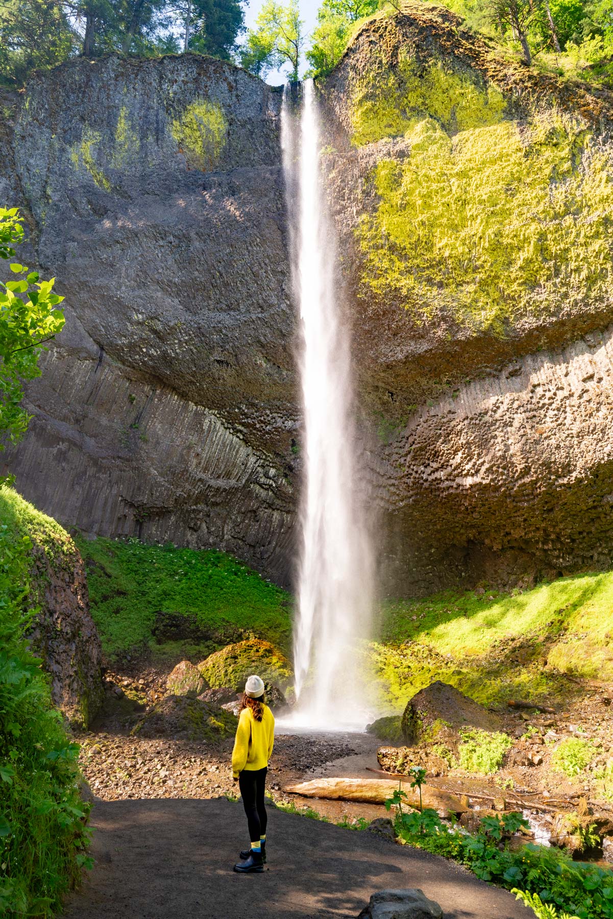
#1. Latourell Falls
- Mileage: 2.4 miles
- Parking Pass Required?: No
- Dogs Allowed? Yes, but must be on a leash
Latourell Falls is the closest Columbia Gorge waterfall to Portland, which makes it one of the most popular hikes in the Gorge.
Thank goodness, because this thing serves as the perfect introduction to the beloved careening waterfalls of the breathtaking Gorge.
This beautiful waterfall plunges an impressive 220 feet. And yes, it’s visible from a parking lot, but where’s the fun in that?
An easy 2.4-mile trail leads visitors directly to the first viewpoint before opening up to a dirt path that heads uphill, giving you a better vantage of Upper Latourell Falls as well.
Big rewards for little effort, is it any wonder this is considered one of the best easy hikes in the Columbia Gorge?
You’ll also enjoy some full-on “forest bathing” on this easy Columbia Gorge hike. Enveloped among Douglas-firs, red cedars, fern-furred maples, and other key plays of the verdant Pacific northwest rain forest, it’s a breath of fresh air (literally).
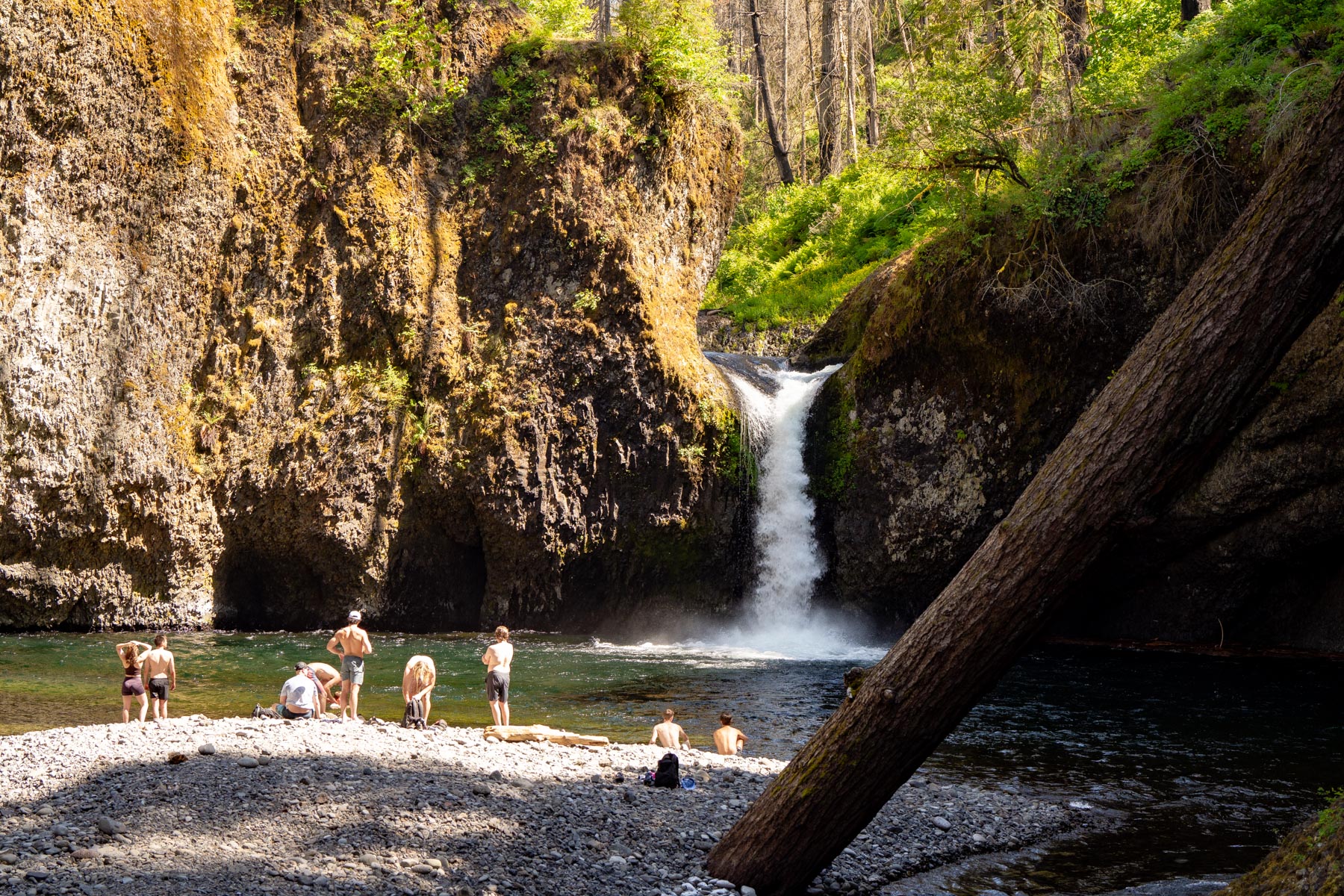
#2. Punch Bowl Falls
- Mileage: 4.2 miles
- Parking Pass Required?: Yes (NW Forest Pass)
- Dogs Allowed? Yes, but must be on a leash
Located about 2-miles into the epic Eagle Creek Trail in the Columbia River Gorge, Punch Bowl Falls is an aptly-named iconic Oregon waterfall well worth exploration.
The full Eagle Creek Trail is a popular Columbia Gorge hiking trail for those that love a challenge (I was sore for days after). The route treks upstream into the mystical high woods.
But the easier (and equally rewarding) 4.2-mile round-trip hike to Punch Bowl Falls, is a much easier affair.
This easy Columbia Gorge hike lives up to to the hype, even with the charred tattoo of the teenager-caused Eagle Creek Fire of 2017. The trail follows towering basalt walls, mammoth conifers, vine-tangled maples and a plethora of cascading waterfalls.
Indeed, every inch of the trail treats hikers to the quintessential Pacific Northwest experience, which is why this is consider one of the best hikes in the Columbia Gorge.
If curious, Punch Bowl Falls gets its name from the shape of the massive pool formation the falls plunge into. Locals swarm to this beloved watering hole in the hot summer months, but take warning – cliff diving is prohibited (and subject to a $300 fine).
Local’s Tip: Check trail conditions before hiking to Punch Bowl Falls. The 2017 Eagle Creek Fire impacted this trail and it was closed for 3+ years before re-opening in 2021. Better safe than sorry, check this resource before heading out.
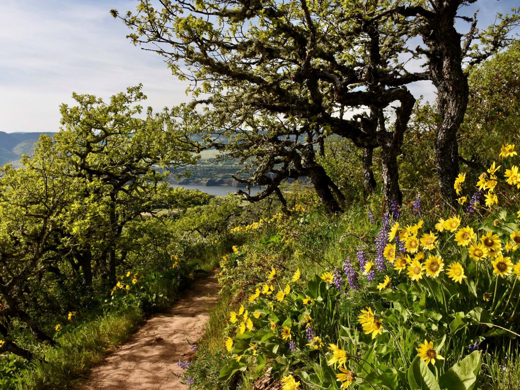
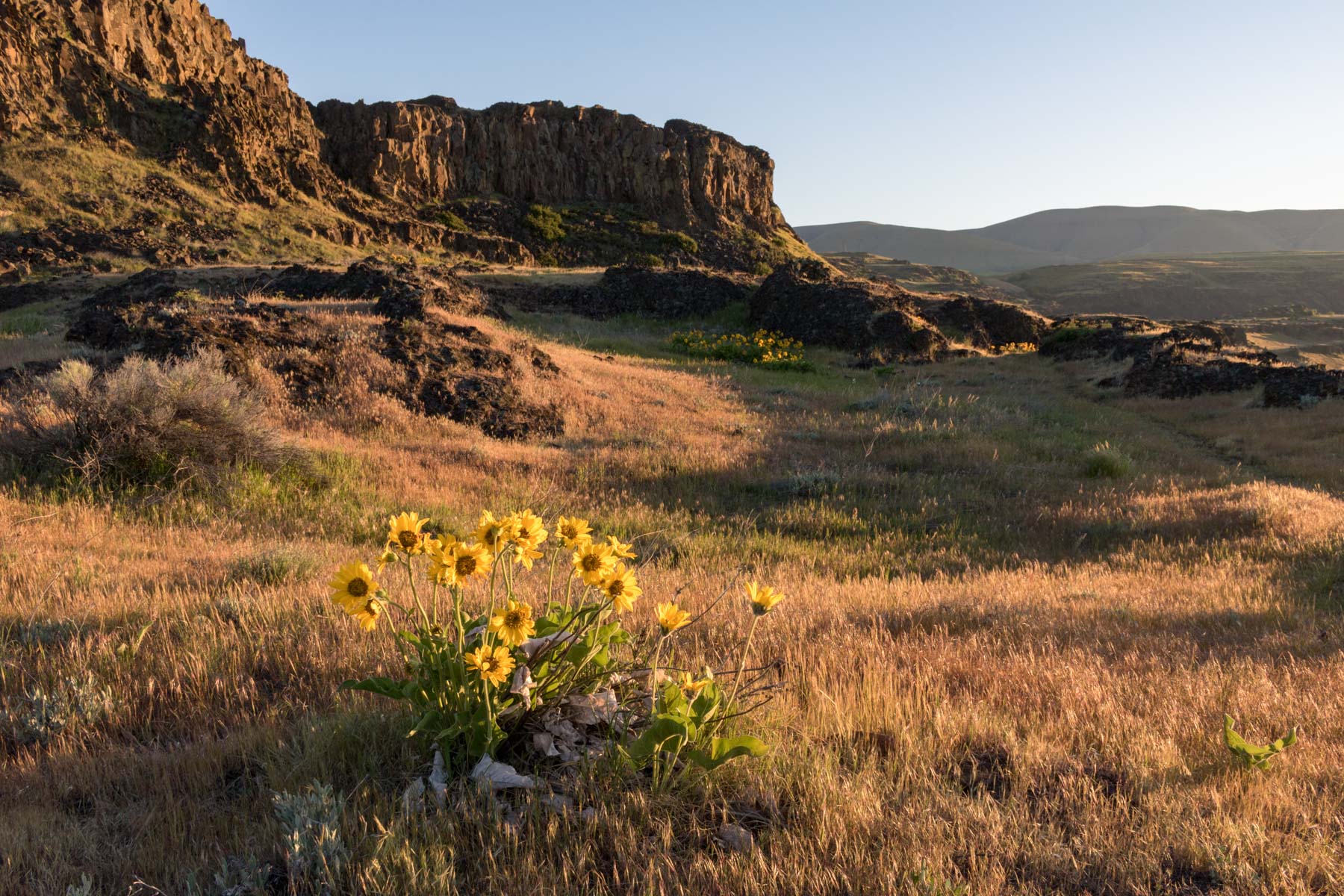
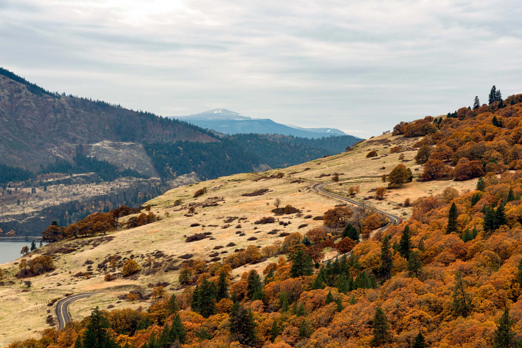
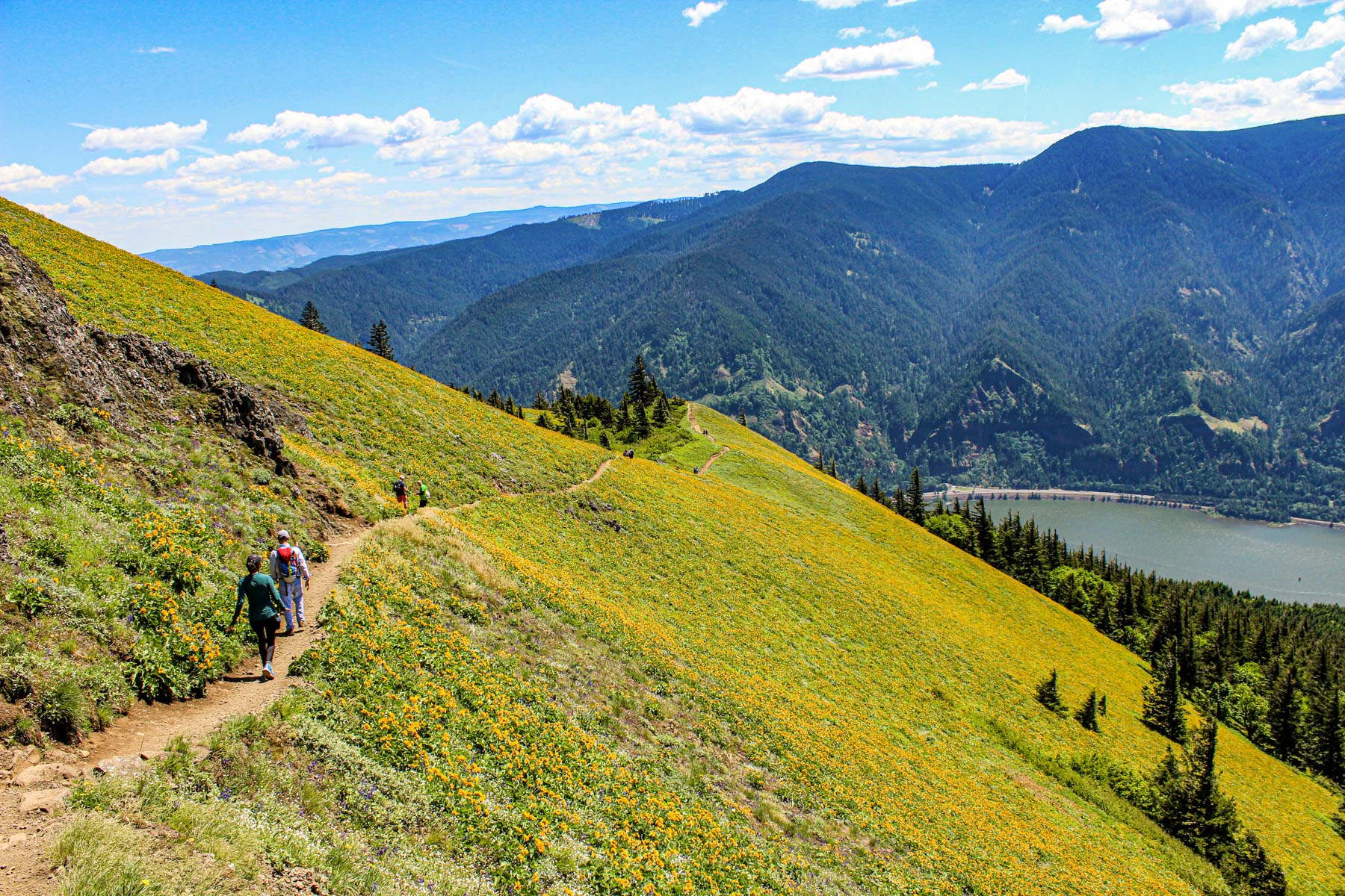
#3. Rowena Plateau
- Mileage: 2.6 miles
- Parking Pass Required?: No
- Dogs Allowed? No
This easy 2-mile Columbia Gorge hiking loop is perched above a clifftop plateau, offering striking views of the sculptural masterpiece that is the Columbia River Gorge.
The start of the show — the Rowena Plateau — immerses you in almost dreamlike beauty, especially in the spring months.
Every April and May, like clockwork, a staggering profusion of vibrant wildflowers flare up in this grassy meadows of this popular hiking trail in the Columbia Gorge.
On one side, the trail weaves its gentle way past panoramic views of the mouth of the Klickitat River below. Look the opposite direction and you’ll see the breathtaking Cascade range on full display, alongside skirts of and densely forested ridges.
Photos will never do this place justice, it’s one of the best Columbia Gorge hiking trails that you have to experience for yourself.
The Plateau Trail is part of the Tom McCall Preserve (a 230-acre area open to the public from March 1st through October 31st). If you’re looking to extend this Columbia Gorge trail, simply tack a hike to McCall Point.
Local’s Tip: Rowena Plateau is one of the best wildflower hikes in the Columbia Gorge. Crowds are all but guaranteed during the spring months, but damn — those wildflowers are something else.
#4. Rooster Rock Loop
- Mileage: 2.7 miles
- Parking Pass Required?: Yes (Oregon States Park Pass)
- Dogs Allowed? Yes, but must be on leash
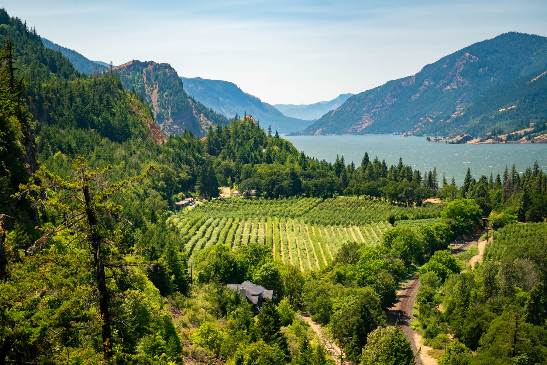
This Columbia Gorge hiking trail takes you down a scenic tour of the Columbia River. and offers unparalleled views of the (rather, ahem, suggestive?) pillar of Rooster Rock.
There’s two trailheads to choose from, opt for the loop (not the summit) if you’re looking for a scenic yet easy hike in the Columbia Gorge.
Much of the route follows the crest of a low, skinny ridge that takes hikers through pretty woods of gnarled oaks, maples, and Douglas-firs covered by shrubs and ferns.
On the east side of this Columbia Gorge hiking trail you’ll notice the scenic willow grasslands (which access a popular nude beach in the summertime). Past that, you’ll see the tall cottonwoods of Sand Island, which give off a special glow at sunset.
All in all, this is one of the easiest hikes in the Columbia Gorge, and doesn’t seem to get too crowded. It’s a great place to stretch your legs (especially if you’re en route to Hood River from Portland!).
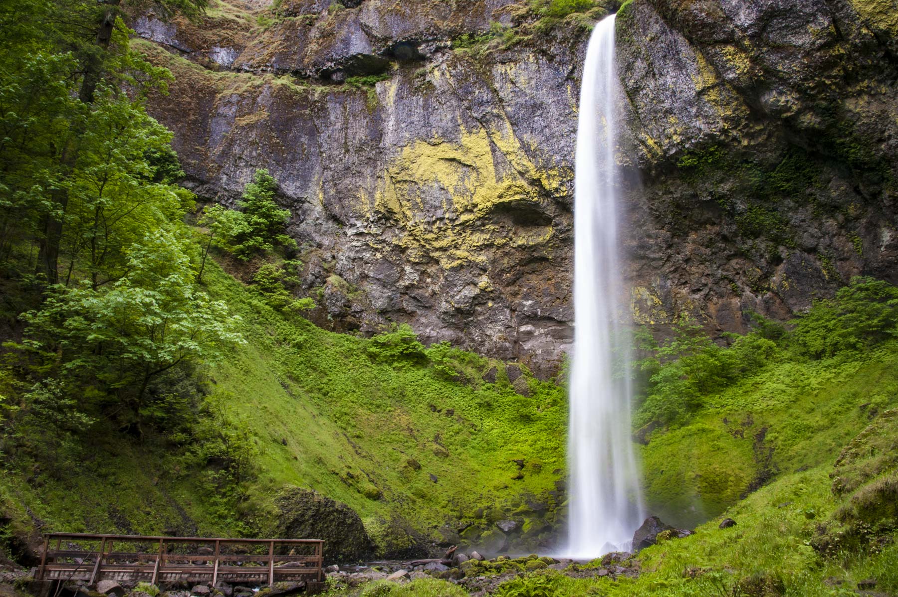
#5. Elowah Falls
- Mileage: 1.5 miles
- Parking Pass Required?: No
- Dogs Allowed? Yes, must be leashed
The trail leading to Elowah Falls is considered one of the most scenic and easier hikes in the Columbia Gorge. Listed at 213 feet high, Elowah Falls is considered one of the tallest waterfalls in the Gorge, reason alone to visit.
Some say that Elowah Falls may be the better part of 300 feet when its multiple tiers are counted together. But the only thing I’m a specialist at is over-thinking, not waterfalls, so I’m just playing the role of messenger on this one.
Regardless of the stats, this is one of the best waterfall hikes in the Columbia Gorge. And sure, nice-looking falls are in no short supply in the area, but the special ones are still worth calling out.
The huge basaltic alcove Elowah Falls commands (which practically glowing green with lichen!), is an unforgettable sight. And if this 0.8-mile mosey to the waterfall only wets your whistle, you can tack on a longer hike to the twin-barrel drop of Upper McCord Creek Falls.
Build your own adventure? Yep. One of the many reasons this is one of the best hikes in the Columbia River Gorge.
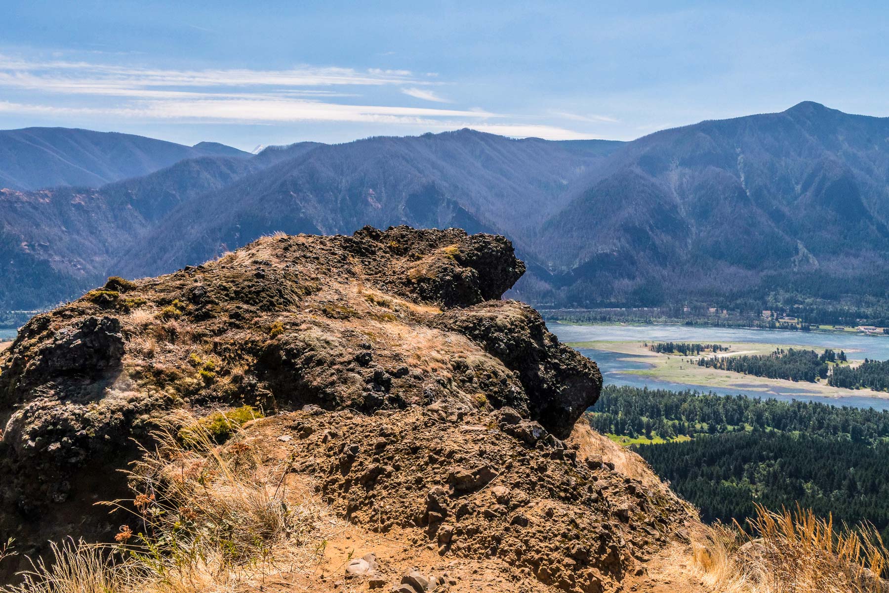
#6. Horsethief Butte
- Mileage: 1.7 miles
- Parking Pass Required?: Yes (Washington Discover Pass)
- Dogs allowed? Yes, must be on leash.
Rounding up this list of the best easy hiking trails in the Columbia Gorge is a personal favorite, the Horsethief Butte Trail.
Allow me to share some helpful info about the Columbia River Gorge. The western side of the Gorge is home to layers of rich basalt that create the perfect conditions for conifer forests to thrive.
The eastern side of the gorge is a different story. The area is semi-arid and offers pronounced features such as naked rock outcroppings.
At this point you may be wondering about this cheeky gorge of ours. Suggestive rock outcroppings, access to nude beaches and now this (naked rocks?!). But listen, I don’t make this stuff up, I merely make observations and share them on a website folks (sometimes) read.
So yes, in this way the Horsethief Butte trail is different from most of the Columbia Gorge hiking trails mentioned so far. You won’t be graced with thick forests and soft ferns, but what this trail lacks in greenery it makes up for in cool rock formations.
An easy trail (and a bit of scrambling) leads to the top of Horsethief Butte, with sweeping panoramas over Horsethief Lake. You’ll also see Lake Celilo, backed up behind the Dalles Dam, and out to the smooth, rolling ranks of the Columbia Hills.
Faded petroglyphs mark some of Horsethief Butte’s rocks, testament to the longtime indigenous use of this eastern portal of the Gorge. The petrophyphs make this is one of the best hiking trails in the Columbia Gorge for history buffs.
Moderate Columbia Gorge Hikes
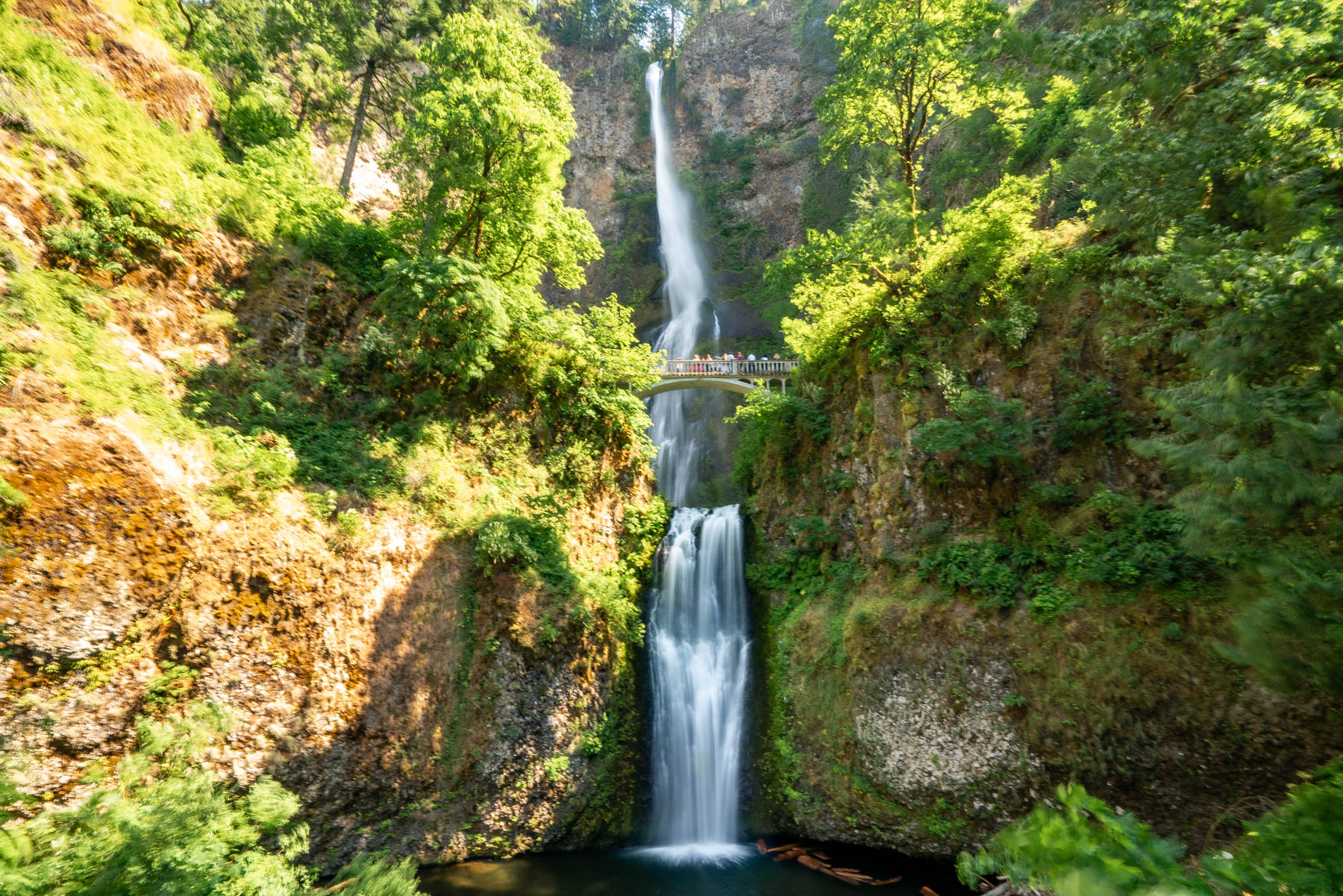
#1. Multnomah Falls Loop
- Note: Timed Entry Only
- Mileage: 5 miles
- Elevation: 1,700 feet
- Parking Pass Required?: Yes, RESERVE in advance
- Dogs Allowed? Yes, must be kept on leash.
C’mon now, you know the drill. Not list of the best hikes in the Columbia Gorge would be complete without mentioning Multnomah Falls.
For whatever reason, Multnomah Falls is sometimes credited as the second-tallest waterfall in the country (which isn’t true, Hawaii takes the cake in that department).
But while Oregon’s most popular hiking trail in the Columbia Gorge doesn’t lead to the tallest waterfall in the nation, it does lead to the tallest in the state.
This monolithic two-tiered waterfall plunges a jaw-dropping 620 foot. The loftiest falls in Oregon, it’s unquestionably breathtaking, and arguably the Columbia Gorge’s single most famous landmark.
Expect the paved path from the Multnomah Falls Lodge up to the Benson Bridge cutting between the upper and lower drops to be thronged. Everyone loves this Columbia Gorge hiking trail.
But taking this semi-rigorous five-mile loop, which includes stretches of trails on Larch Mountain, Wahkeena Falls, and Return trails, allows you to ditch at least some of the crowds.
Besides that showstopping plummet of Multnomah Creek (down an amazing stack of basalt layers), you’ll also get to to experience lesser-visited (but still lovely) waterfalls.
From the 55-foot curtain of Ecola Falls to the meandering 242-foot drop of Wahkeena Falls, this long Columbia River Gorge hike makes for a memorable day.
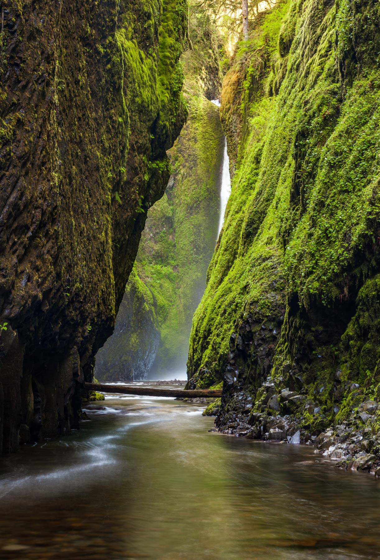
#2. Oneonta Gorge
- Mileage: 1 mile
- Parking Pass Required?: No
- Dogs Allowed? Yes, must be leashed (and make sure they can swim!)
The defining vibe of the Columbia Gorge is sprawling grandeur, with the huge river muscling between soaring (and often mist-scrawled) cliffs. Hitting depths of 200 feet deep in some places, some as narrow as 20 feet across.
Nowhere is there a better example of the range of hikes in the Columbia Gorge than the Oneonta Gorge hiking trail.
Representing a very different character: tucked-away, shadowy, and intimate — there’s a mystical vibe to this trail few can resist.
No formal trail traces this mossy slot canyon upstream; from the roadside pullout by the Oneonta Tunnel, you proceed by scrambling over rocks and logs and wading the creek itself.
(Summer, with its lower—and warmer—water, is best for this hike.) This is also one of many utterly remarkable waterfall hikes in the Gorge: The tight-walled, magical defile leads to the beautiful, hundred-foot streamer of Oneonta Falls—a heck of a turnaround point.
Indeed, it’s these mystical fairy-tale like features that make Oneonta Gorge one of the best hikes in the Columbia River Gorge.
**Important: As of this writing (April 2023), Oneonta Gorge remains closed because of the impacts of the 2017 Eagle Creek Fire. It’s a spectacular-enough (and popular-enough) Columbia Gorge hike though, so it warrants inclusion here, to be enjoyed whenever it reopens.
#3. Angel’s Rest
- Mileage: 4.8 miles
- Elevation: 1,500 feet
- Parking Pass Required?: No
- Dogs Allowed? Yes, must be on a leash
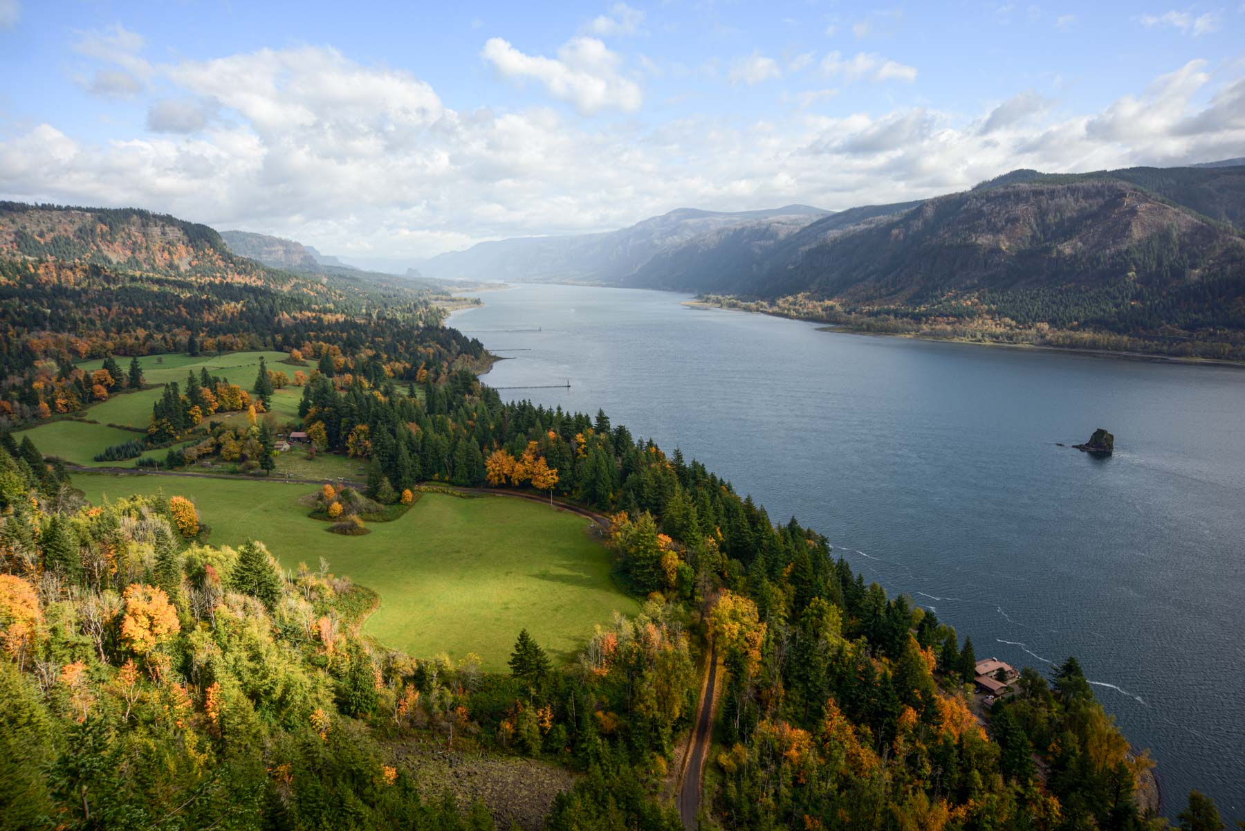
A great gateway eminence on the western side of the Columbia Gorge, Angel’s Rest offers a stunning bare-rock promontory some 1,500 feet above river level.
You’ll have to huff and puff your way up some switch-backs from the Historic Columbia River Highway trailhead to be rewarded with the panoramic views this popular Columbia Gorge hiking trail offers.
But even before the rewards of the summit, you’ll get a fill of stirring vistas from the various wildfire-snagged slopes and rock expanses en route.
The vantage from the cliff-girt volcanic spine of Angel’s Rest include signature landmarks like Hamilton and Table mountains to the northeast, Cape Horn and Beacon Rock along the river, and Silver Star Mountain dominating the northern skyline.
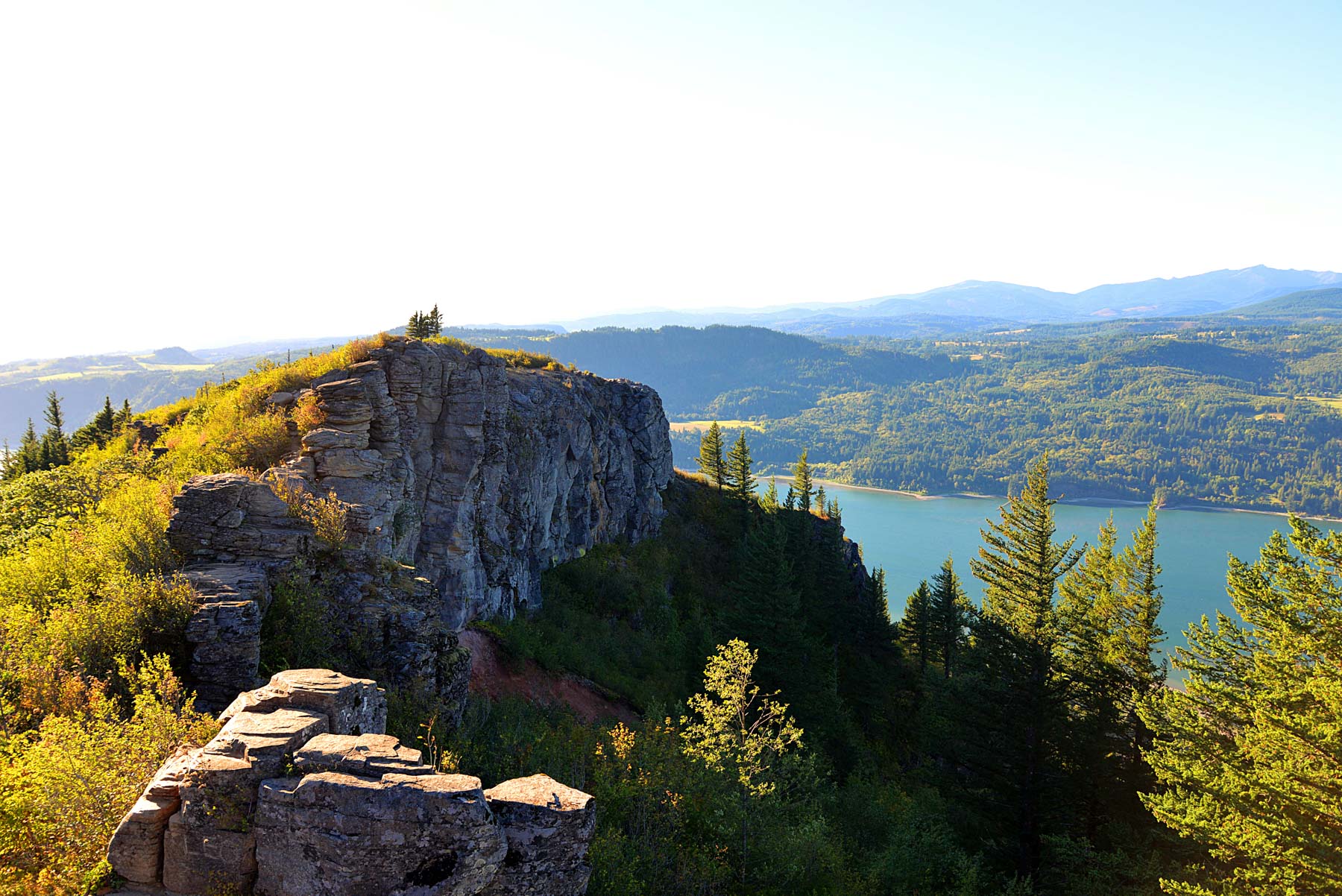
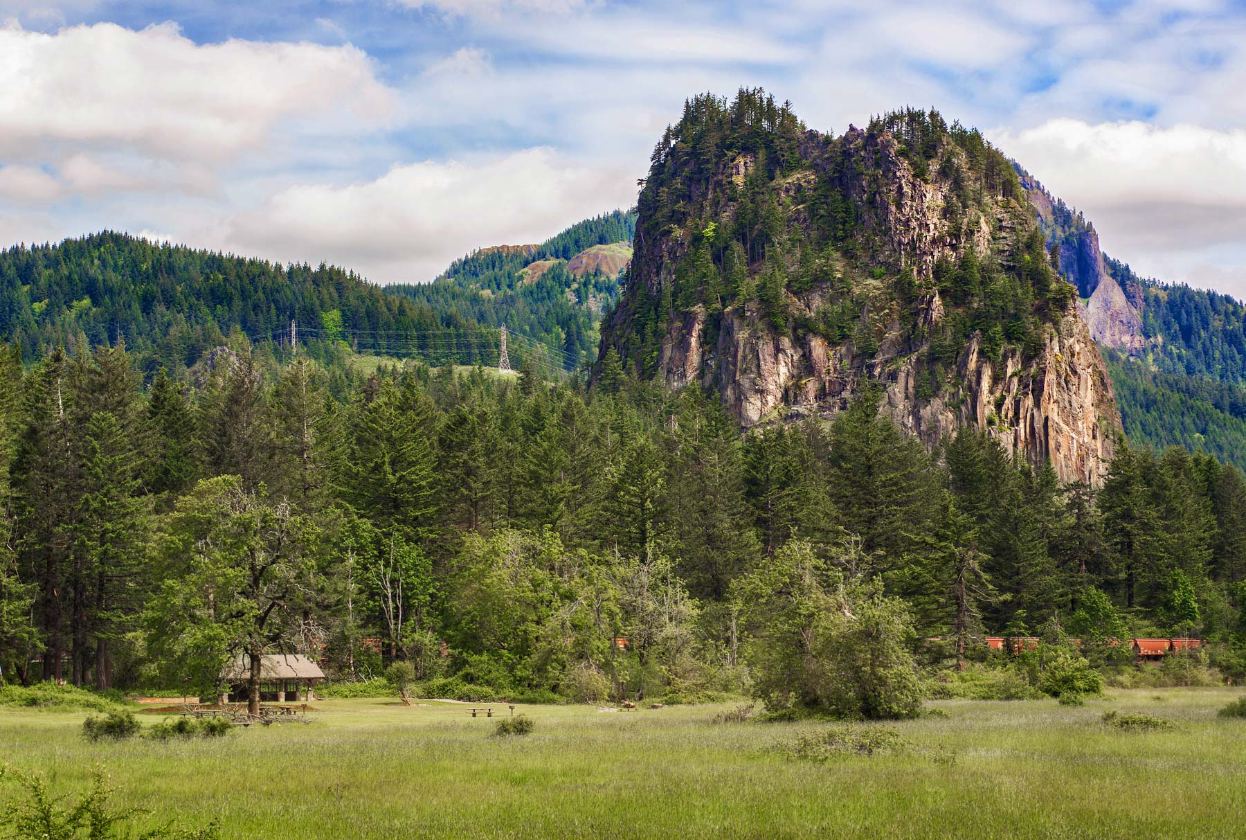
#4. Beacon Rock
- Mileage: 2 miles
- Elevation: 850 feet
- Parking Pass Required?: Yes (Washington Discover Pass)
- Dogs Allowed? Yes, but must be on a leash
Named by none other than Captain Clark, Beacon Rock is a tried and true staple for those that love hiking in the Columbia Gorge. Located on the Washington side, I’ve lost count of the number of times I’ve embarked on this scenic trail.
Heck, I even took my in-laws here. This was their first hike in the Columbia River Gorge as well.
The bold, riverfront monolith of Beacon Rock soars to 850 feet high, earning it a place among the Columbia Gorge’s most recognizable landmarks.
This 57,000-year-old volcanic rock is part of the same (hilariously named) Boring Volcanic Field that peppers the east side of Portland with little buttes.
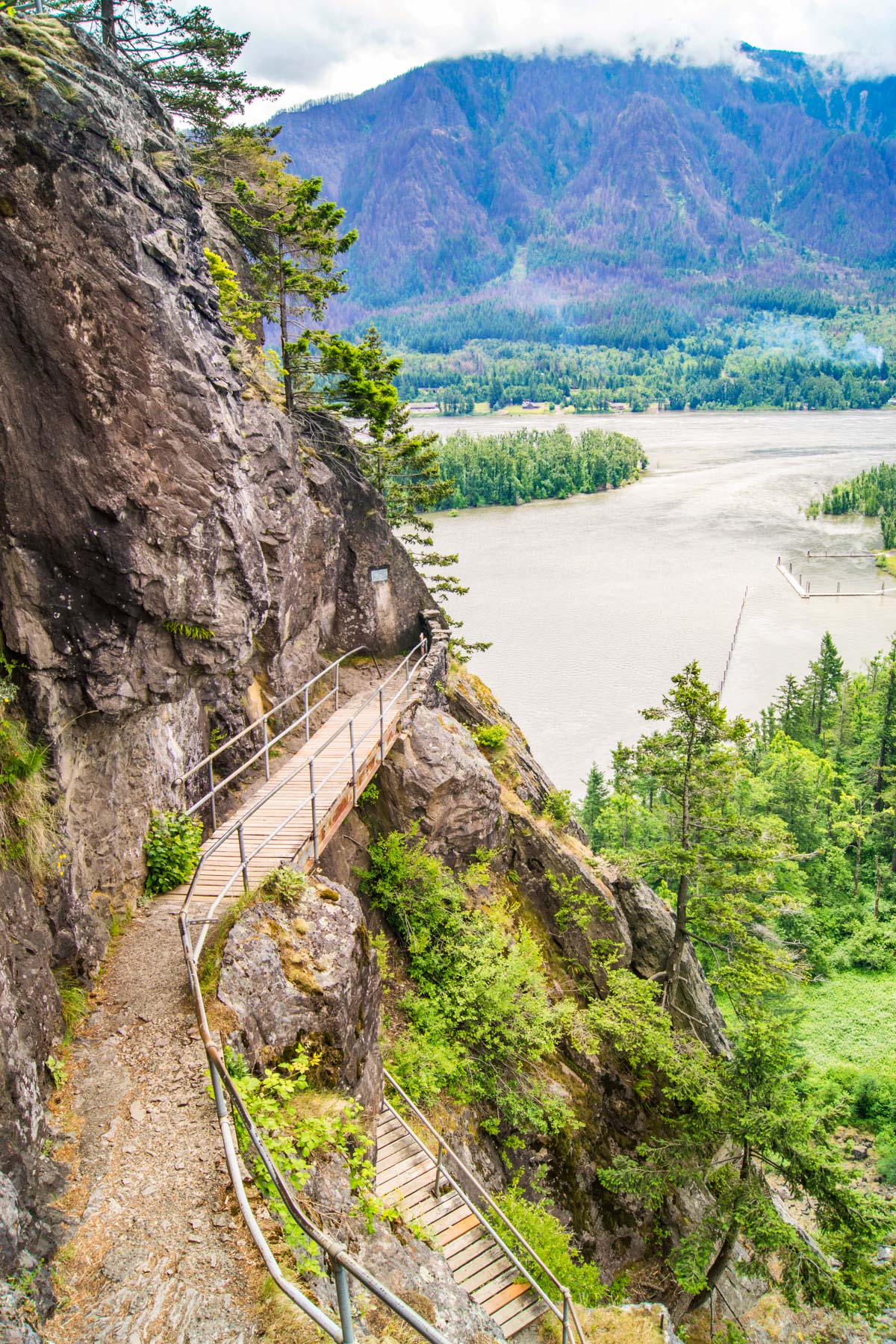
Sitting at the riverbank and offering unparalleled panoramic views from the top, if you’re up for a hearty challenge, hike to the summit. The elevation gain clocks in at an impressive 850 feet, which is guaranteed to get your heart pumping.
The heavily switch-backed trail is outfitted with railings and bridge sections dating back to 1918. This popular Columbia Gorge hiking trail was originally built by Henry Biddle, who purchased Beacon Rock a few years before to save it from quarrying and development.
Ascending such a distinctive spire is thrilling and doesn’t lose its magic, regardless of how many times you’ve been to the summit.
For many locals, Beacon Rock is a introduction to the epic Columbia River Gorge. Many of my friends consider this the best first hike in the Columbia Gorge because it’s challenging but offers unbeatable views.
#5. Cape Horn
- Mileage: 7.4 miles
- Elevation: 800 feet
- Parking Pass Required?: No
- Dogs Allowed? Yes, must be on leash
The tiered cliffs of Cape Horn, the riverfront basalt wall forming the southeastern foot of Mount Zion, serves as an unforgettable gateway to the western reach of the Columbia Gorge on the Washington side.
This 7.2-mile loop, which incorporates the Cape Horn Trail and a hike along paved, single-lane Cape Horn Road, offers spectacular views over the river from vantages such as Pioneer Point and the Nancy Russell Overlook.
The unmistakable nub just offshore is Phoca Rock: christened by Lewis and Clark for the harbor seals they observed in the flow here.
Sprawling fields of loose rocks, wind-worn Douglas-firs, Salmon Creek and Cape Horn falls, not to mention the sheer cliffs make the Cape Horn Loop a strong contestant for best hikes in the Columbia River Gorge.
Just remember that the lower part of the loop is closed from February 1st through July 15th to safeguard nesting peregrine falcons, though you can still enjoy a rewarding out-and-back during that window.
#6. Coyote Wall (via the Maui Loop)
- Mileage: 3.8 miles
- Elevation: 1,775 feet
- Parking Pass Required?: No
- Dogs Allowed? Yes, must be on a leash
As spectacular as the towering, rain-slammed, lushly clad forests of the Columbia Gorge’s west side are, the drier eastern reach provides its own remarkable, sun-blasted scenery.
The Little Moab and Little Maui trails in the Columbia Gorge on the Washington side, also popular among mountain bikers, provide an up-close look at a remarkable the east-side most notable landmark.
The towering Coyote Wall, a dipping basalt cliff locally known as “the Syncline.” This epic fold, which marks the headwall of an ancient landslide, is yet another awe-inspiring geologic wonder in the Gorge.
So if you’re looking to shake things up after visiting the most forested hiking trails in the Columbia Gorge, I suggest trying your hand (hiking boots?) at the Coyote Wall trail.
Challenging Columbia Gorge Hiking Trails
#1. Table Mountain
- Mileage: 15.5 miles
- Elevation: 3,400 feet
- Parking Pass Required?: Yes (NW Forest Pass)
- Dogs Allowed? Yes, on leash
Flat-topped Table Mountain (which can appear more pyramidal depending on the angle) stands among the most commanding peaks of all the trails on the Washington side of the Columbia River.
This long, arduous hike—one of the most challenging Columbia Gorge hikes, mind you—attains the 3,417-foot summit from the Bonneville Trailhead. The trail uses portions of the Tamanous, Pacific Crest, and West Table Mountain trails.
Soaring Table Mountain serves up stirring views of the Columbia Gorge and the Cascade crest. But the huge, intimidating cliffs of the mountain’s south face are just as impressive. So is the bird’s-eye view of the Bridge of the Gods.
These inedible sights are unforgettable and made the strenuous effort worthwhile. So yeah, Table Mountain is one of the most challenging hikes in the Columbia Gorge, but damn – those views are worth the effort.
#2. Hamilton Mountain Trail
- Mileage: 7.5 miles
- Elevation: 2,200 feet
- Parking Pass Required?: Yes (Washington Discover Pass)
- Dogs Allowed? Yes, must be leashed
The Hamilton Mountain trail in the Columbia Gorge has it all. From cascading waterfalls to steep cliff sides and dense forests, the natural wonders of this hike span the gamut.
The trail kicks off with a moderate climb that meanders past a thick forest of Douglas Firs before spitting you out at some power lines (told you this Columbia Gorge hike had it all). Fret not, the power line portion is brief, stay the course and make the steep ascent to the summit.
En route to the top you’ll be rewarded with great views of the Columbia River and the Bonneville Dam. Keep going up the trail and about 1 mile into your hike you’ll start to see waterfalls. Rest your legs and enjoy the views before continuing the ascent up.
The last stretch of the hike can start to feel tiring (the elevation gain is no joke!). Make sure you’re wearing sturdy hiking books with good traction because the switch-back is no stranger to loose rocks. Continue until you reach the summer where you can park yourself at the various viewpoints.
This is one of the best hikes in the Columbia Gorge for a picnic. The views are unbeatable and, covering a distance of 7.5 miles, you’ll spend the better half of a sunny day on the trail.
#3. Mount Defiance
- Mileage: 11.6 miles
- Elevation: 4,960 feet
- Parking Pass Required?: No
- Dogs Allowed? Yes, must be on a leash
That’s right, we’re saving the best for last. Among the grandest views in the Gorge lures hardy hikers to the summit of Mount Defiance.
Considered one of the most strenuous hiking trails in the Columbia Gorge, this bad boy clocks in a nearly 5,000 feet, making it the highest peak directly along the Gorge.
We’re talking about 4,800 feet of elevation gain, so you’re going to earn those far-reaching panoramic views.
The hike starts at the Starvation Creek Trailhead, you’ll pass some pretty waterfalls (Cabin Creek, Lancaster) and alternate between shady, thick forests, open glades and burned stands.
Nearing the summit, you’ll traverse typical Cascadian forests full of of noble firs and shaggy mountain hemlock. The views stretch past Columbia Gorge ramparts such as Shellrock, Wind, Dog, and Table mountains beyond to the great snow-capped peaks of Mounts Hood, St. Helens, Rainier, and Adams.
The mountainous views make this one of the best hikes in the Columbia Gorge. I’ve done the hike twice and while challenging, it’s one of the most memorable too.
Best Hikes in the Columbia Gorge (Post Overview)
In sum, here’s a roundup of the best hiking trails in the Columbia Gorge, organized by difficulty level.
Best Easy Hikes in the Columbia Gorge
- Latourell Falls
- Punchbowl Falls
- Rooster Rock Loop
- Rowena Plateau
- Elowah Falls
- Horsethief Butte
Moderate Columbia Gorge Hikes
- Multnomah Falls Loop
- Oneonta Gorge
- Angel’s Rest
- Beacon Rock
- Cape Horn
- Coyote Wall (via the Maui Loop)
Difficult Columbia Gorge Hiking Trails
- Table Mountain
- Hamilton Mountain
- Mount Defiance
Map of the best Columbia Gorge Hikes
best hiking trails Columbia gorge, most beautiful hikes in the Columbia Gorge, best easy hiking trails Columbia Gorge, best Columbia Gorge hiking trails,
Columbia Gorge Best Hikes (Pins)


What do you think?